The Napali Coast: Kauai's Roadless Shore And How To See It
Sixteen miles of cliffs, zero miles of road. The Napali Coast is the reason Kauai has one of the densest boat-tour rosters in Hawaii, and understanding why it has no road explains every tour decision you are about to make.
Short answer
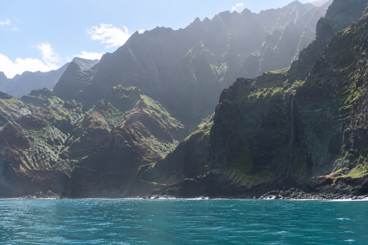
The Napali Coast is a 16-mile roadless stretch of sea cliffs and valleys on Kauai's northwest shore, protected as the 6,175-acre Napali Coast State Wilderness Park. No road reaches it, so almost everyone sees it from a boat, a helicopter or the 11-mile Kalalau Trail. Boat tours start at $190 per person and leave from Port Allen or Kikiaola.
Sixteen miles of cliffs, zero miles of road. That single sentence is the whole reason this website exists, and it is worth slowing down on before you compare a single tour. The Napali Coast is the stretch of Kauai that cars cannot reach, that the state protects as a wilderness park, and that nearly every visitor ends up seeing from the deck of a boat. The decisions that follow, which harbor, which vessel, which month, all flow from geography, so this guide starts with the geography itself.
Where Is The Napali Coast?
The Napali Coast is the 16-mile northwest-facing shoreline of Kauai, the westernmost of the main Hawaiian Islands, running roughly from Kee Beach in the north to Polihale in the south. It lies entirely inside Napali Coast State Wilderness Park, and the nearest full-service harbors are Port Allen and Kikiaola, both on the island's west side. The state's Division of State Parks describes the park as lying along the rugged 16-mile northwest side of the island, and that number, 16 miles, is the one to hold onto when tour itineraries start blurring together.
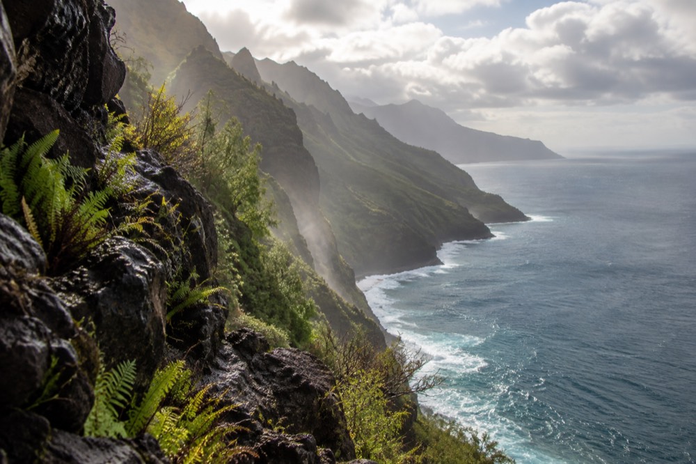
To locate it from your rental car: the coast starts down the hill from Haena State Park at the end of Kauai's north shore road and ends near Polihale State Park at the end of the west side road. Between those two endpoints there is nothing but cliff. Hanalei, the famous north shore town, sits roughly 41 miles and an hour and a half of driving from Lihue Airport, and the west-side harbors sit a further long drive around the island's southern half. That geography matters more than most first-time visitors expect, and we return to it in the harbor planning later in this guide.
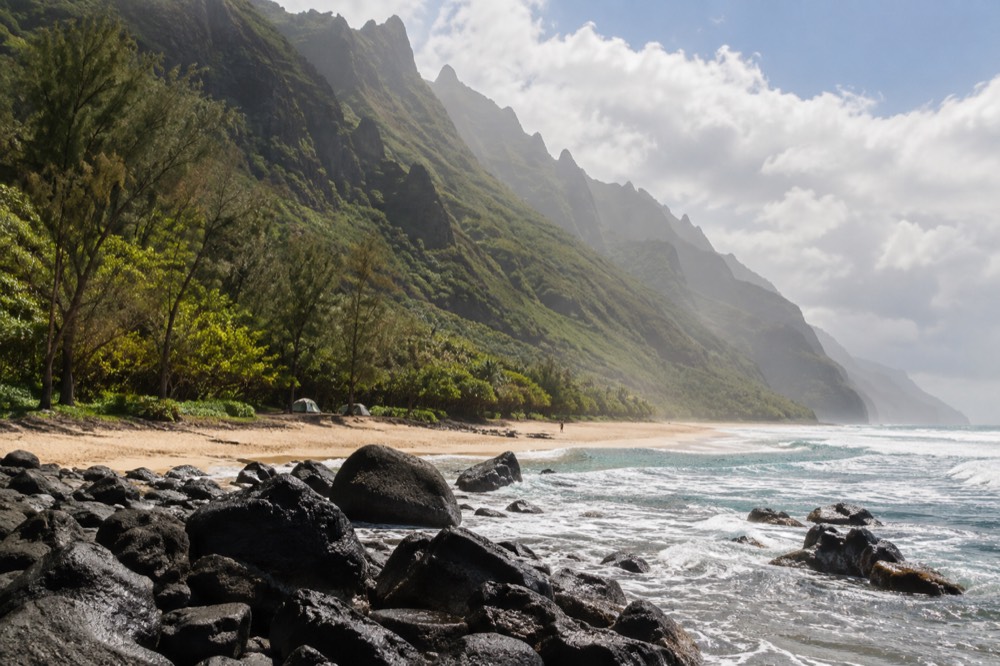
The coast itself is a series of deep, narrow valleys cut into the flank of an ancient shield volcano, each valley ending at the sea in a cliff or a sliver of beach. Waterfalls still incise the valleys while the ocean carves the cliff bases, a slow fight between water above and water below that the state park's own description notes directly. Stone-walled terraces from ancient Hawaiian taro cultivation survive on some valley floors, which is why so much of this shoreline is managed as an archaeological and ecological reserve rather than a recreation free-for-all.
One orientation note that saves real confusion: the coast faces northwest, not west. Winter North Pacific swells hit it almost head-on, summer swells largely miss it. That single fact drives the entire seasonal rhythm of Kauai boat tours, from which months the rafts run to which tours the operators even sell in January. The season logic is covered in full in the Napali Coast boat tour season guide.
Why Is There No Road?
No road reaches the Napali Coast because the cliffs rise up to 4,000 feet almost directly from the ocean in places, and the valleys that cut through them are too steep, too wet and too unstable for any highway to survive. Engineers never built one, and the state has since locked the coastline inside a wilderness park where new construction is off the table entirely. The absence is not an accident of planning. It is the defining physical fact of the island's northwest quadrant.
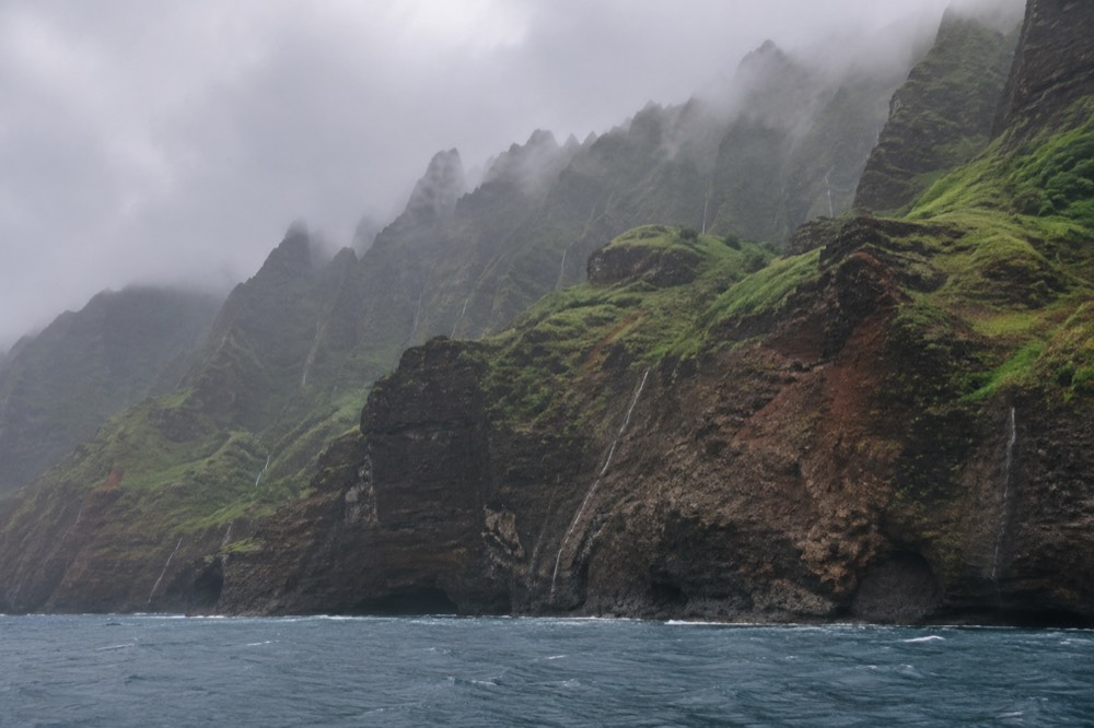
Kauai is one of the oldest islands in the chain, and the Napali Formation basalts that make up its bulk have had roughly five million years of erosion thrown at them. Rainfall on the island's interior summit, Waialeale, is among the highest on Earth, and all that water drains northwest through valleys like Kalalau, Honopu and Nualolo. The result is terrain where a road would need either impossible switchbacks up 3,000-foot ridges or bridges across canyons that no highway department has ever attempted. The upper submarine slopes off the coast are even scalloped by massive ancient landslide amphitheaters, evidence of how unstable this flank of the volcano has been over geologic time.
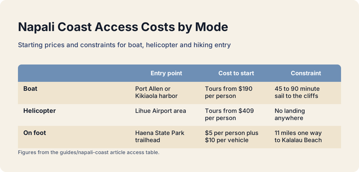
The practical consequence is that only three access modes exist, and each has a hard entry point:
| Access mode | Entry point | What it costs to start | Practical constraint |
|---|---|---|---|
| Boat | Port Allen or Kikiaola harbor, west side | Tours from $190 per person | Roughly a 45 to 90 minute sail to reach the cliffs |
| Helicopter | Lihue Airport area | Published tours from $409 per person | Weather windows close fast; no landing anywhere |
| On foot | Haena State Park trailhead, north shore | $5 per person entry plus $10 per vehicle parking | 11 miles one way to Kalalau Beach; permits required beyond mile 2 |
That table is the honest skeleton of every Napali plan. The Kalalau Trail guide covers the walking option in depth, and the helicopter versus boat comparison does the same for the air option. What matters here is the pattern: the road stops, and everything after that point costs money, time or serious physical effort.
It is worth saying plainly that the no-road fact is also why the commercial scene here is unusually stable. Under a December 2024 court order clarified by the state's Division of Boating and Ocean Recreation, no new Commercial Use Permits are being issued for Hawaii waters and existing permittees may not increase passenger capacity. The operators running this coast today are, in effect, a fixed pool. You can read the state's own clarification of the permitting status on the DLNR Division of Boating and Ocean Recreation page.
How Big Is The Coastline?
The Napali Coast runs 16 miles along Kauai's northwest shore, and the state wilderness park that protects it measures 6,175 acres. The coastline crosses five major valleys before ending at Kalalau Beach, and the trail through them is 11 miles one way, which most hikers in good condition need a full day to walk. Those are the official numbers, from the state park's own records and the Division of State Parks trail description, and they are worth internalizing because tour marketing tends to blur them.
Sixteen miles sounds modest until you see it. The cliffs do not step down gently; they hold height for the entire run, so a boat traveling the coast spends hours inside a corridor of vertical green. The 6,175-acre park figure comes from the state's own data book, and the acreage is almost entirely valley walls and ridge tops, which is why the park has no drivable interior and no developed facilities beyond the trail corridor.
For scale comparisons that actually help planning, think in travel time rather than miles. A power catamaran from Port Allen spends about 45 minutes to an hour reaching the southern end of the coast and then runs the length of it over several hours. A raft from Kikiaola starts closer to the cliffs and spends its time hugging them. A helicopter crosses the whole thing in minutes. The 16 miles is the same in every case, but the experience of that distance is completely different, which is exactly the trade the later sections of this guide unpack.
What Is Nāpali Coast State Wilderness Park?
Napali Coast State Wilderness Park is a 6,175-acre state park protecting the coast and its five valleys, managed by Hawaii's Division of State Parks. It contains the 11-mile Kalalau Trail, two legal landing beaches for kayaks, an ancient archaeological complex at Nualolo Kai, and camping rights limited to Kalalau valley with a five-night maximum. The park designation is what makes the rules that confuse so many visitors.
The rules worth knowing before you plan anything, straight from the Division of State Parks park page:
| Activity | Legal status in the park | What you need |
|---|---|---|
| Boating past the coast | No permit required for transit | Nothing beyond the operator's own licenses |
| Landing passengers on shore | Only three permitted raft concessionaires | A tour with one of those operators |
| Kayak landing | Legal only at Kalalau with a camping permit, and at Milolii | Camping permit, summer season only |
| Hiking to Hanakapiai | Legal day use | Haena State Park entry reservation |
| Hiking beyond Hanakapiai | Legal only with overnight permit | Napali camping permit, up to 5 nights |
| Drone flying in state parks | Prohibited without written state approval | Nothing available to visitors |
Two of those rules surprise people constantly. First, no permit is required to travel the coast by boat; the permits attach to landing, which is why only three companies, named by State Parks on its boating page, may put passengers ashore at Nualolo Kai. Second, commercial boat drop-offs and guided camping packages are explicitly illegal, and the state says so in unusually direct language. If you see an advertisement for a boat-supported Napali camping trip, the state's own advice is to assume it is illegal.
The camping permits themselves cost $25 per person per night for Hawaii residents and $35 for non-residents, open for booking up to 90 days in advance, and they sell out months ahead for summer dates. The trailhead side is a separate system: entry to Haena State Park requires a $5 per person day-use reservation plus a $10 per vehicle parking reservation for non-residents, bookable 30 days out through the official Haena State Park reservation page. Residents are exempt from both fees with state ID.
The park also protects the marine edge. Hawaiian monk seals, one of the rarest seal species on Earth, haul out on these beaches, and both state and federal law set viewing distances: 50 feet from a seal, 150 feet from a mother with a pup, and 100 yards from any humpback whale from a vessel. Tour captains operate under these rules daily, which is one reason a licensed tour is a calmer way to encounter the coast's wildlife than going it alone.
What Can You See From The Water?
From a boat you see the entire 16-mile coastline at cliff height: the sea caves at the southern end, the Honopu arch and beach, the hanging valleys, waterfalls, spinner dolphins in the leeward waters, and from December through April, humpback whales. Most tours add a snorkel stop, and raft tours can enter sea caves when the swell allows, which larger catamarans cannot. The water is the only vantage that runs the coast's full length at its most dramatic scale.
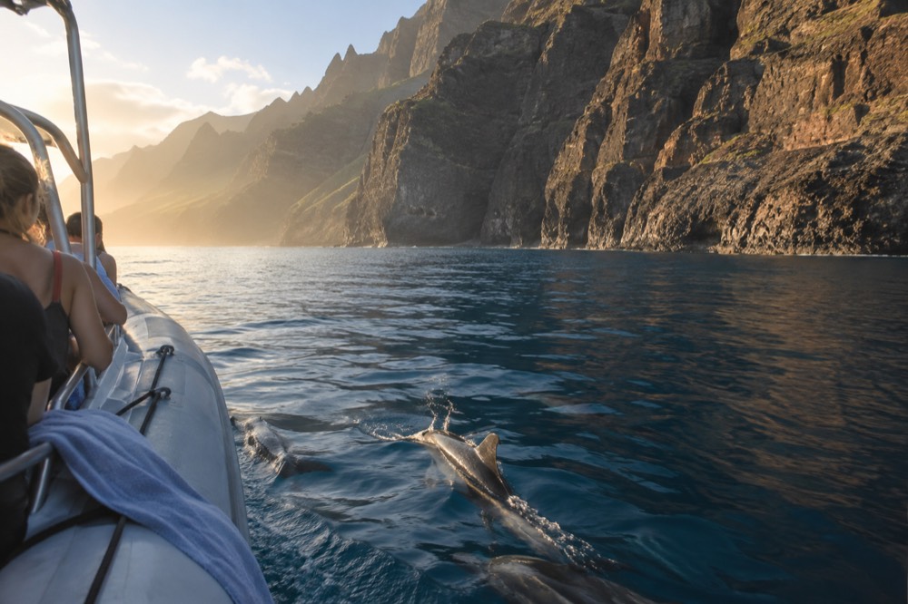
The caves deserve their own sentence of honesty, because marketing copy routinely overpromises them. No operator on this coast guarantees cave entry, and several disclaim it in writing: entry depends on the ground swell on the day, decided by the captain at the cave mouth, not by the brochure. Rigid-hull inflatable rafts are the vessels built for entering them; large sailing catamarans are not. The raft-versus-catamaran distinction is the single biggest fork in choosing a water tour, and the Napali Coast raft tours guide covers it in full.
Three tours from this site's roster show the spread well:
| Tour | Vessel | Duration | From | Rating and reviews |
|---|---|---|---|---|
| Na Pali Coast Zodiac Raft Expedition and Snorkeling | Rigid-hull inflatable raft | 4 hours | $255 per person | 4.9 from 956 reviews |
| Na Pali Coast Super Raft Snorkel Adventure | Rigid-hull inflatable raft | 4 hours 30 minutes | $235 per person | 4.8 from 1723 reviews |
| Na Pali Boat Tour on the Amelia K | Power catamaran | 5 hours | $227.13 per person | 4.9 from 2050 reviews |
The zodiac expedition out of Kikiaola is the one this site points most readers toward for a first Napali run: it departs the harbor closest to the cliffs, carries snacks, and its 4.9 rating across 956 reviews is one of the strongest review pools on the roster. The full index of guides sits on Napali Coast Boat Tours.
For readers who want the fuller picture of which tour fits which traveler, the best Napali Coast boat tour guide ranks the whole roster. What the water view gives you that nothing else can is time inside the corridor: hours, not minutes, with the cliffs passing slowly enough that the valleys register as places rather than postcards.
What Can You See From The Air?
From a helicopter you see the coast's full vertical scale in under an hour: the 4,000-foot ridgelines, the interior valleys that no trail or boat reaches, Waialeale's crater and waterfalls that are invisible from the water. Federal rules hold Hawaii air tours at 1,500 feet above the surface, so you see the coast from a distance rather than at cliff level, and no aircraft lands anywhere along it. The air view trades intimacy for scale.
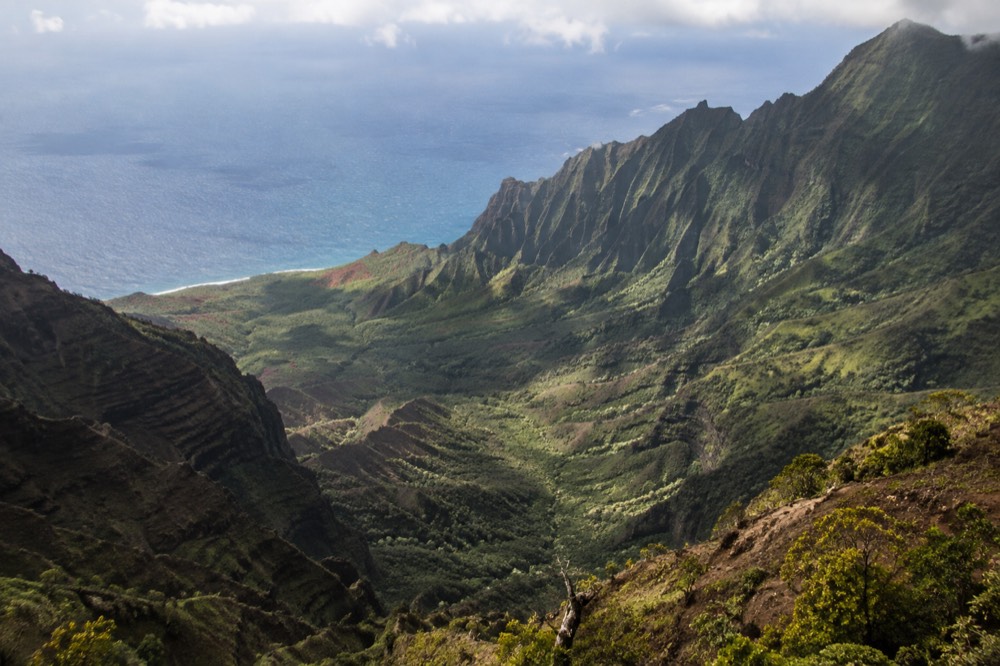
The regulatory floor matters more than most travelers realize. Under 14 CFR Part 136, the standard minimum altitude for Hawaii air tours is 1,500 feet above the surface, per the current federal air-tour rules. That is a comfortable, safe distance, but it means the helicopter Napali you remember is a panorama, not a close-up. Boats, by contrast, pass within yards of the rock. Which of those two experiences you want is a genuine personal call, not a ranking.
Price is the other honest difference. Blue Hawaiian Helicopters, the state's largest operator, lists its Kauai Eco Adventure 50-minute tour at $409 per person and its Discover Kauai 45-minute small-group tour at $499 per person on its own Kauai tours page. Against a boat-tour floor of $190 per person on this site's roster, the air option costs roughly double for a fraction of the time. What it buys is access: the interior of the island, the crater, and valleys that neither the trail nor the boats touch.
Weather decides more air tours than travelers expect. A coast that sits under cloud for the morning grounds helicopters while boats still run the leeward waters, and a day with a strong marine layer can mean the flight you booked for the cliffs spends its time over cloud tops. Boat tours get rerouted or rescheduled too, but the sea state on the west side is often workable when the ceiling is not. Booking whichever you choose early in your stay, so there is a spare day to rebook, is the single most repeated piece of operator advice on this coast.
What Can You See On Foot?
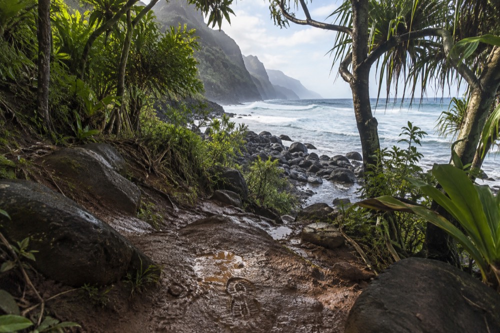
On foot you see the coast one mile at a time, starting from Haena State Park at the trailhead and crossing Hanakapiai Beach at mile two, then continuing valley by valley to Kalalau Beach at mile 11. Beyond Hanakapiai every hiker must hold an overnight camping permit, and the full walk to Kalalau takes most fit hikers an entire day each way. The trail is the only way to stand on the coast itself without a boat landing.
The Kalalau Trail traverses five major valleys, per the state's own trail description, and it is famously unforgiving: narrow, muddy in places, with stream crossings and exposed sections. The first two miles to Hanakapiai Beach are the day-hike portion and need only the Haena entry reservation. Everything past that point requires the camping permit described earlier in this guide, and the state's blunt advice is that swimming at Hanakapiai is dangerous in almost all conditions due to currents and no lifeguards.
| Trail section | Distance one way | Permit needed | Realistic time |
|---|---|---|---|
| Trailhead to Hanakapiai Beach | 2 miles | Haena day-use entry only | Half day round trip |
| Trailhead to Hanakapiai Falls | 4 miles round trip from beach | Haena day-use entry | Full day |
| Trailhead to Kalalau Beach | 11 miles | Napali camping permit, 5 nights max | Full day each way |
For travelers weighing the walk against a boat day, the honest comparison is coverage versus depth. The trail gives you one beach and one valley in a full day of effort; a boat gives you all five valleys and both ends of the coast between breakfast and dinner. Some visitors do both, hiking to Hanakapiai on a north-shore morning and taking a west-side boat tour on a different day, and the Kauai itinerary with a boat day guide shows how the two fit together without doubling your driving.
There is also a middle path worth naming: raft tours that may include a beach landing at Nualolo Kai. Only the three permitted raft concessionaires can put passengers ashore there, and the landing includes time at an archaeological complex of ancient stone terraces, Bishop Museum excavations documented habitation at the site across some 800 years. It is the only way to stand on the Napali shore without hiking 11 miles, and the Nualolo Kai tours guide covers which products include it.
What Is The Easiest Way To See It?
For most visitors the easiest way to see the Napali Coast is a half-day boat tour from Port Allen or Kikiaola, which covers the full 16-mile shoreline for a starting price of $190 per person with no fitness requirement, no permits and free cancellation on every tour on this roster. Helicopters cost roughly double and give less time over the coast, and the trail demands a full day of hard hiking to see one valley. Ease and experience line up unusually well here.
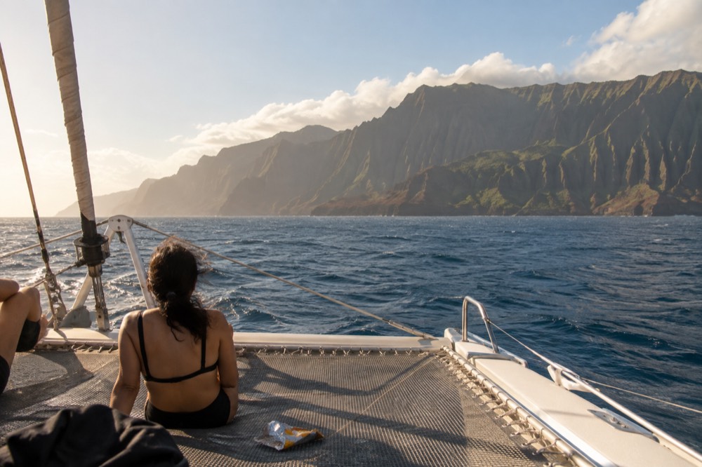
The practical mechanics are simple. All 26 tours on this site depart from two harbors: 18 from Port Allen near Eleele on the south-west shore, 8 from Kikiaola near Waimea and Kekaha on the west side. There is no north-shore harbor on this roster, so wherever you stay on Kauai, your boat day includes a drive to the west side, usually 30 to 60 minutes from the south-shore resorts and longer from the north shore. The getting to Port Allen and Kikiaola guide covers the drive times, parking at both harbors and the bus option, and it is worth reading before you book a departure time.
Choosing between the tours comes down to three questions. Do you want cave entry? Book a raft, and accept that the captain decides on the day. Do you want calm and shade with a meal? Book a catamaran with lunch or dinner included. Do you want the shortest possible time on the water? The 3-hour zodiac options from Kikiaola reach the cliffs fastest. A sailing catamaran with two meals included, like the six-hour snorkel and sail from Port Allen, sits at the relaxed end of that spectrum and suits travelers who treat the boat day as the day's whole activity rather than one item on a list.
Whichever way you go, book early in your stay rather than on your last day. Ocean conditions, wind and swell are the primary reason tours cancel or adjust routes, and every operator on this coast offers a reschedule or a full refund when they do. A tour booked on day two of a week leaves six spare days; the same tour booked for your final morning leaves you with photographs of a parking lot. That is the one piece of advice every operator on this coast repeats, and it is the one this guide will end on.
Common Questions About The Napali Coast
Where Is The Napali Coast?
The Napali Coast is the 16-mile northwest-facing shoreline of Kauai, running roughly from Kee Beach in the north to Polihale in the south. It lies entirely inside the 6,175-acre Napali Coast State Wilderness Park, and the nearest harbors for boat tours are Port Allen and Kikiaola on the island's west side.
Why Is There No Road?
The cliffs rise up to 4,000 feet almost directly from the ocean, and the valleys cutting through them are too steep and unstable for any highway. No road was ever built, and the state has since protected the entire coastline as a wilderness park where construction is not permitted.
How Big Is The Coastline?
The coastline runs 16 miles, and the state wilderness park protecting it measures 6,175 acres. The Kalalau Trail through the park crosses five major valleys and runs 11 miles one way to Kalalau Beach, a walk that takes most fit hikers a full day.
What Is Napali Coast State Wilderness Park?
It is a 6,175-acre state park managed by Hawaii's Division of State Parks, protecting the coast, its valleys and archaeological sites. It contains the Kalalau Trail, two legal kayak landing beaches, and camping limited to Kalalau with a five-night maximum and permits bookable 90 days ahead.
Can A Boat Tour Land Me On The Napali Coast?
Only three permitted raft concessionaires, named by State Parks, may land passengers on the shore, at Nualolo Kai. Commercial boat drop-offs for camping are explicitly illegal, and kayaks may only land at Kalalau with a camping permit or at Milolii in summer.
What Is The Easiest Way To See The Napali Coast?
A half-day boat tour from Port Allen or Kikiaola is the easiest option for most visitors: it covers the full 16-mile coastline, starts at $190 per person on this roster, needs no permits or fitness, and every tour listed here carries free cancellation.