Why Is The Napali Coast So Famous?
The Napali Coast of Kauai is famous for 16 miles of sea cliffs up to 4,000 feet tall, ancient Hawaiian valleys you can only reach by boat or a long trail, and its starring roles in Hollywood films.
Why Is The Napali Coast So Famous?
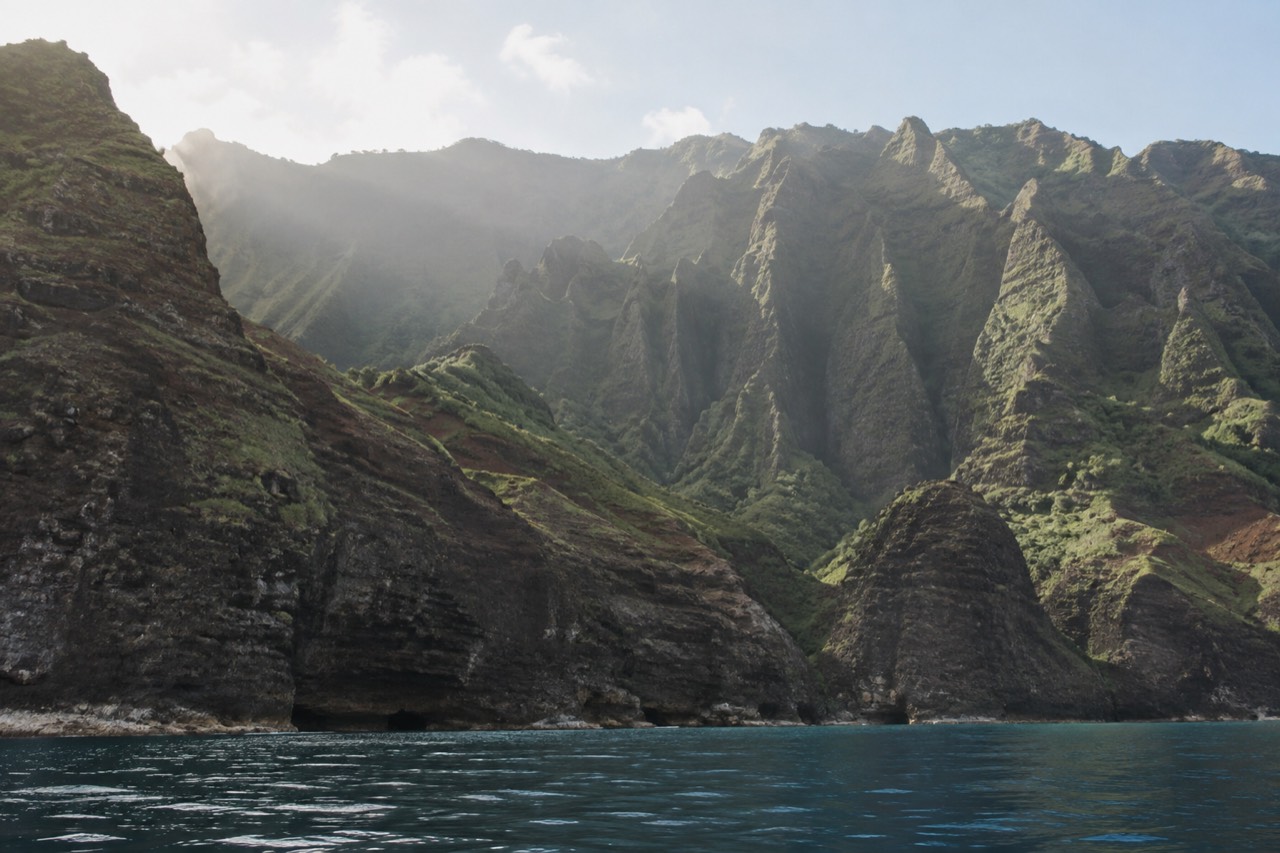
The Napali Coast State Wilderness Park covers 6,175 acres along the rugged 16-mile northwest side of Kauai, and almost none of it can be reached by car. That single fact drives nearly everything people associate with the name: cliffs that plunge straight into the Pacific, valleys that stayed inhabited for centuries after the rest of the island changed, and a coastline that Hollywood keeps borrowing as a stand-in for somewhere impossible. The fame is not marketing. It is geography doing the work.
Why Is The Napali Coast So Famous?
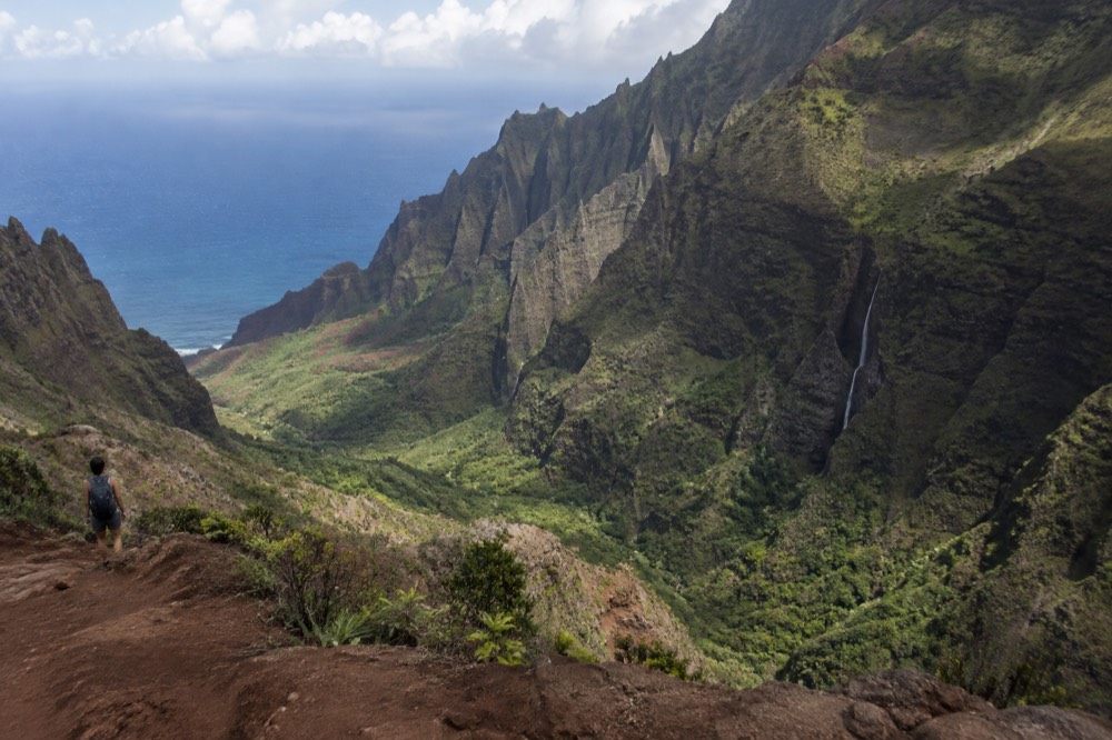
The Napali Coast is famous for the sheer scale of its scenery and the fact that almost nobody can touch it: 16 miles of cliffs and hanging valleys on a 6,175-acre wilderness park, reachable only by boat, by a demanding 11-mile trail, or from the air. Most of the world saw it in photographs and films long before ever visiting, which is why the boat tour has become Kauai's signature booking.
The name itself means "the cliffs" in Hawaiian, and the coast delivers on it without interruption. Deep, narrow valleys end abruptly at the sea, waterfalls still cut down the valley walls, and the ocean keeps carving the cliff base while the streams keep carving from above. The state park's own description notes extensive stone-walled terraces on the valley floors, remnants of taro cultivation from a period when thousands of people lived along this shoreline. Today the same valleys hold no roads, no power lines and no resorts, which is rarer than it sounds anywhere in Hawaii.
There is also a practical reason the coast is so photographed: the viewing geometry works. From the water, the cliffs rise in wall after wall, each valley framed against the next, and the light changes through the whole stack as the boat moves. From the air the whole system reads at once. From the trail you get one valley at a time and earn each one. Very few coastlines on earth offer all three perspectives of the same feature, and none of them with a tropical climate.
The fame compounds itself in an honest way. People who have seen the photographs book the boat tour, and the boat tour produces the next round of photographs. If you are planning to be one of them, these are the three trips that best match the classic Napali experience.
How Old Are The Cliffs?
The cliffs are the eroded edge of a shield volcano roughly four to five million years old. Ian McDougall's potassium-argon dating, published in Earth and Planetary Science Letters, gives the Napali Formation basalts ages from 5.14 plus or minus 0.20 to 3.81 plus or minus 0.06 million years, with a mean of about 4.43 million years for the main shield construction. The cliffs themselves are younger: they are what is left after that long.
Kauai is the oldest of the main Hawaiian islands, and the Napali coast is its most dramatic wound. The island was built by a single enormous shield volcano whose lavas stacked in layer after layer, and the northwest side of that pile has been falling into the sea ever since. Wave attack cuts the base, streams cut the top, and the valleys between the ridges are the scars of that double erosion. The green you see from a boat is not rock painted green: it is vegetation clinging to slopes that are still, on geological timescales, in motion.
The deep structure beneath the coast tells the same story at a larger scale. A 1989 study by Moore and colleagues in the Journal of Geophysical Research found that the upper submarine slopes off north Kauai are scalloped by three amphitheater-like indentations, interpreted as the heads of major slope failures, with the northwestern one sitting offshore from the Napali coast itself. In plain terms, pieces of the island have slid into the ocean in colossal blocks, and the steep amphitheater shape of the coast's valleys is partly inherited from those collapses.
How Tall Are They Really?
The cliffs along the coast commonly rise between about 1,000 and 4,000 feet from the water, and the tallest faces are among the highest sea cliffs in the world. The exact figure varies by ridge and by how you measure, but the experience from a boat is consistent: the wall keeps going up well past the point where you expect it to stop, and the people on the beach at the valley floor look like ants.
The numbers matter less than the proportion. A 4,000-foot cliff face is taller than three Empire State Buildings stacked, and it does not step back in tiers the way most mountain scenery does. It goes up in one sweep, often shadowed in the morning and lit gold in the afternoon, with waterfalls that turn to mist before they land. Boat captains know this and time their runs so the light moves along the wall as the tour progresses.
The height also explains the coast's weather. The cliffs force the trade winds upward, which is why the valleys catch rain that the leeward waters a few miles offshore do not see, and why a tour can leave a dry harbor under blue sky and pass through a brief shower in front of a green wall. Operators are blunt about this on their own FAQ pages: rain alone does not cancel a tour, and it is common for it to be raining on land while the water stays clear.
For scale of a different kind, the comparison with the air option is stark. Federal rules keep Hawaii air tours at a standard minimum altitude of 1,500 feet above the surface, so a helicopter sees the cliffs from a respectful distance. A boat sees them from underneath, close enough that the geology is overhead.
What Did Ancient Hawaiians Build There?
Ancient Hawaiians built stone-walled terraces, house platforms and irrigation systems across the Napali valleys, and the coast supported communities for centuries. The most studied site is Nu'alolo Kai, a valley floor and beach at the base of the cliffs where Bishop Museum archaeologists excavated habitation terraces between 1958 and 1964, recovering layered deposits from a settlement occupied from around the twelfth century into the twentieth.
Nu'alolo Kai is the site that makes the coast's human history concrete. It sits at the foot of the cliffs, reachable by sea and by a steep cliff trail, and its terraces and walls were excavated in four seasons by Bishop Museum teams. Radiocarbon evidence reported in the Journal of the Polynesian Society places the earliest occupation as far back as the fourteenth to early fifteenth century, and researchers studying the site describe continuous habitation spanning some 800 years. A community lived at the bottom of a 1,000-foot wall, farming, fishing and trading by canoe, for most of a millennium.
The terraces themselves were built for taro, and the state park's description of the coast notes them specifically: stone-walled terraces on the valley floors, evidence of cultivation that needed both water and labor on a scale that implies real population. The valleys were not refuges or seasonal camps. They were working agricultural landscapes, with the streams that still run today harnessed into pondfields.
Today Nu'alolo Kai is the one place along the coast where a boat tour can legally put passengers on the shore. State Parks lists only three concessionaires with permits to land there, and describes the visit as a guided walk through an archaeological complex with snorkeling off the landing. It is the closest a modern visitor can get to standing where those families stood, and it is available only on specific raft tours, only when conditions allow.
Why Is It Protected?
The coast is protected as a state wilderness park because it holds intact native ecosystems, hundreds of years of Hawaiian archaeology, and a shoreline that cannot be reached except on foot or by water. Protection is enforced in specific ways: only three permitted operators may land passengers at Nu'alolo Kai, kayaks may land at only two beaches, and commercial boat drop-offs for campers are explicitly illegal.
The park's rules are unusual in how precisely they draw the lines. Traveling along the coast by boat requires no permit at all; what is regulated is going ashore. State Parks publishes the list of concessionaires legally permitted to land passengers, and outside those permits, the only land access is the Kalalau Trail through Hā'ena State Park, which itself requires advance reservations for non-residents: $5 per person for entry and $10 per vehicle for parking, booked up to 30 days ahead. Camping deeper in the park is capped at five nights and permits open 90 days in advance.
Some of the protections exist precisely because the temptation runs the other way. State Parks states plainly that it is illegal for anyone to provide commercial boat transportation for drop-off or pick-up at the Kalalau or Miloli'i camping areas, and that commercial guided camping trips by boat and hiking are illegal too. The rule exists because people tried it. Kayak landings are likewise prohibited at every beach in the park except Kalalau Valley with a camping permit and Miloli'i, and the kayak season itself runs only from May 15 to September 7, when the sea state allows it.
Marine protections extend into the water. Hawaiian monk seals, green sea turtles and humpback whales around Kauai are covered by federal and state approach rules, and Hawaii law bans the sale of sunscreens containing oxybenzone or octinoxate, the two chemicals most often implicated in coral damage. The wilderness designation is not a single fence; it is a stack of rules, each answering a specific past pressure.
Why Has Nobody Built A Road?
No road exists along the Napali Coast because the terrain never allowed one and the wilderness designation now forbids it. The valleys are separated by ridges that drop thousands of feet, the shoreline is a cliff rather than a shelf, and the only land route through the park remains the 11-mile Kalalau Trail, an unpaved footpath crossing five major valleys that takes most fit hikers a full day each way.
The engineering case comes first. A road along this coast would have to cut across the mouth of every major valley, hanging on cliff faces that are still actively eroding, in a rain belt where the streams flood and the slopes move. On an island where even the coastal highway on the calm south and east sides hugs flat land, the northwest shore offered no flat land to hug. The historical trail was the solution the terrain permitted: up and over each ridge, down each valley, on foot.
The legal case then locked the answer in place. Once the coast became a state wilderness park, road building was off the table by definition, and the trail itself became the managed access point, with entry controlled through the Hā'ena reservation system and camping capped by permit. The result is a strange and valuable thing: a 16-mile coastline in the middle of a developed island, with no vehicle within miles of most of its length.
That inaccessibility is the engine of the fame, not a side effect of it. Every photograph that made the coast famous was taken from a boat, a helicopter or a hard-earned ridge, because there is nowhere to take one from a car. The road that was never built is the reason the view still exists.
What Films Made It Famous?
The coast's film career runs through some of the biggest adventure titles ever shot in Hawaii, with the Honopu Arch and the cliff walls standing in for fantasy landscapes. Makana Charters' own site credits the arch with appearances in King Kong and Pirates of the Caribbean, and the coast's silhouette has been used repeatedly wherever a film needed somewhere that looked untouched by the modern world.
The reason directors keep coming back is the same reason the coast is famous at all: it reads as prehistoric. There is no building, no road, no boat mooring in the frame unless the production puts one there. A camera pointed at the cliffs captures a landscape that could plausibly exist before humans, or after them, which makes it perfect for dinosaurs, castaways and pirate coves alike.
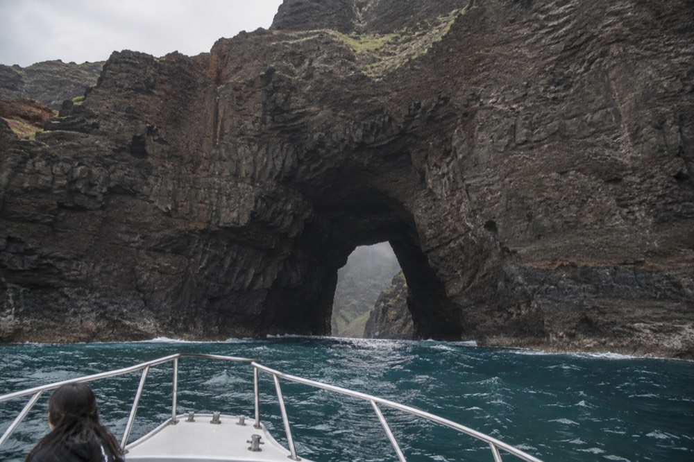
Honopu Arch is the single most filmed feature. It is a real, gazetted landform, a natural arch at the mouth of Honopu Valley, and its silhouette is instantly recognizable even to viewers who could not name it. The arch sits in the section of coast with no legal landing at all, so almost every image of it ever published was taken from the water or the air. Films shot on the Napali Coast get their own full treatment in our piece on films shot on the Napali Coast, including the specific productions and locations.
The film history loops back into tourism in a direct way. Guests on boat tours ask the crew which cliff was in which movie, and the captains answer with the same points on every trip: the arch, the beach at the head of the valley, the waterfall ridges. The coast is one of the few places where the location scout's shortlist and the boat route are the same list.
How Do Most People See It Today?
Most people see the Napali Coast from a tour boat, and nearly all of those boats leave from Port Allen or Kikiaola on Kauai's west side, because there is no road and the trail is a two-day commitment. Boat tours on this roster run from $190 to $361.31 per person for 3 to 8 hours, while helicopter flights start at $409 per person for under an hour at a legal minimum altitude of 1,500 feet.
The boat is the majority choice for good reasons: it is the only way to see the cliffs from below, the only way to enter the sea caves in a raft, the only way to snorkel the coast's reefs, and the only legal way to set foot on the shore at Nu'alolo Kai. The classic full experience is the 6-hour snorkel and sail, which carries breakfast and lunch and rates 4.8 from 582 reviews. A shorter but equally well-reviewed option is the 5-hour sail from Port Allen, which rates 4.8 from 106 reviews and includes a deli lunch and breakfast. The power-catamaran alternative, the 5-hour Amelia K tour with lunch included, rates 4.9 from 2,050 reviews and is the most-reviewed trip on the coast.
| Way to see the coast | Typical cost | Time required | What you get |
|---|---|---|---|
| Boat tour from Port Allen or Kikiaola | $190 to $361.31 per person | 3 to 8 hours | Cliffs from below, sea caves by raft, snorkelling, possible shore landing at Nu'alolo Kai |
| Kalalau Trail on foot | $5 entry plus $10 parking at Hā'ena | Two days each way for the full 11 miles | One valley at a time, earned views, camping at Kalalau with a permit |
| Helicopter flight | From $409 per person | 45 to 50 minutes | The whole coast at once, from a regulated 1,500 feet minimum altitude |
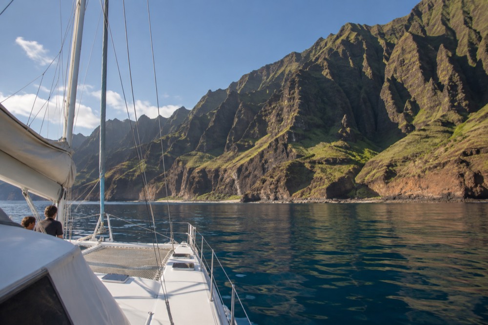
The comparison with the other two access routes is worth stating honestly. The trail costs $5 in entry fees but two days of hard walking each way, and the views are earned one valley at a time. The helicopter costs more than any boat tour and shows everything at once, but from a regulated distance, with no caves, no snorkeling and no shore time. This site, Napali Coast Boat Tours, covers the sea option in depth because that is what most visitors choose, and our guide to the best way to see the Napali Coast breaks the trade-offs down trip by trip.
Whichever format you pick, the underlying fact is the same one that made the coast famous: there is still no other way in. The fame began with the cliffs, and the cliffs have outlasted every attempt to make them easy.
Common Questions About The Napali Coast
Why Is The Napali Coast So Famous?
It is famous for 16 miles of sea cliffs and hanging valleys on a 6,175-acre wilderness park with no road access, plus a long film career and centuries of Hawaiian settlement visible in its terraces. Almost everyone sees it from a boat, which has made the Napali boat tour Kauai's signature excursion.
How Old Are The Cliffs?
The volcano that built them is roughly four to five million years old; potassium-argon dating of the Napali Formation basalts gives a mean age of about 4.43 million years for the main shield. The cliffs are the eroded edge of that ancient pile, still being cut by waves and streams today.
How Tall Are They Really?
The cliff faces commonly rise between about 1,000 and 4,000 feet from the water, among the tallest sea cliffs in the world. From a boat the wall keeps climbing well past what you expect, and the scale is the single thing guests mention most.
What Did Ancient Hawaiians Build There?
Stone-walled taro terraces, house platforms and irrigation systems across the valleys. The best-studied site, Nu'alolo Kai, was excavated by Bishop Museum teams between 1958 and 1964 and shows habitation spanning some 800 years.
Why Is It Protected?
It is a state wilderness park holding native ecosystems and major archaeology, protected by strict rules: only three permitted operators may land passengers at Nu'alolo Kai, kayak landings are limited to two beaches, and commercial boat drop-offs for campers are illegal.
How Do Most People See It Today?
By boat, on tours that depart Port Allen or Kikiaola and run 3 to 8 hours, from $190 to $361.31 per person on this roster. The alternatives are the 11-mile Kalalau Trail on foot or a helicopter flight from $409 per person.